Analyzing Local Weather and Climate Data

When it comes to improving crop yield and maintaining sustainable agriculture, understanding and controlling environmental factors such as weather conditions and local microclimates is essential. Thanks to technological advancements, including the integration of drones into agri-food systems, farmers now have powerful tools to monitor and analyze these key parameters.
Before deploying drones to optimize your agriculture, a crucial step is to create a comprehensive aerial map of your land. This mission will provide a detailed overview of your crops, soil, water, and other critical elements of your operation.
With their ability to fly over vast expanses, drones can capture high-resolution images and videos. This valuable data will help you identify potential issues affecting your crops, such as soil erosion, pest infestations, weed invasions, or diseases.
In addition to visual surveillance, drones incorporate cutting-edge technologies to collect precise data on your crops. They can measure height, density, and biomass of your plantations, comparing this information with historical data or established benchmarks. This in-depth analysis allows you to track the progress of your crops and adjust your farming practices accordingly to maximize yields and optimize farm management.
Once your aerial exploration by drone is complete, the next step is to leverage the collected images and videos to create accurate field maps. This crucial step will allow you to visualize and analyze your data more effectively, making informed decisions to optimize your agricultural operation.
Creation of orthomosaics and elevation maps
Diverses solutions logicielles et applications existent pour assembler les images aériennes et générer des ortho mosaïques. Ces cartes numériques offrent une vue d'ensemble précise de vos champs, en restituant les dimensions et les positions réelles des éléments au sol. De plus, des logiciels spécialisés permettent de créer des cartes d'élévation, qui représentent le relief de vos terrains avec précision.
Advanced mapping for better planning
In addition to orthomosaics and elevation maps, more sophisticated tools allow you to generate contour maps and 3D models of your fields. Contour maps illustrate variations of a specific variable, such as height or soil fertility, through level curves. As for 3D models, they offer an immersive and interactive representation of your terrain, facilitating the planning and visualization of your crop interventions.
Advanced mapping for better planning
Leveraging these accurate maps offers numerous advantages for optimizing your agricultural practices:
- Precise planning of plantings and sowings
- Optimized management of irrigation and fertilization
- Monitoring and analysis of crop growth
- Detection and prevention of potential issues
- More efficient and targeted harvesting

The potential of drones extends beyond aerial mapping. They can also play a crucial role in monitoring and tracking your crops throughout the season, allowing you to gain in-depth understanding of their growth, health, and quality.
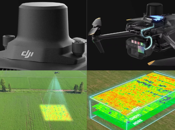
Equipped with sophisticated sensors, drones can collect a wealth of data on your crops, ranging from color and temperature to humidity and nutrient levels. This information, invisible to the naked eye, provides a holistic view of your plantations and enables precise analysis of their development.
In addition to standard sensors, drones can incorporate advanced imaging technologies such as near-infrared, red-edge, or thermal. These technologies reveal insights not visible to the naked eye, allowing early detection of stress, diseases, or damage in your crops.
Analyzing data collected by drones allows you to:
- Identify problem areas and intervene promptly
- Adjust farming practices to improve crop health and growth
- Forecast yields and optimize inventory management
- Harvest crops at the optimal time to maximize quality.
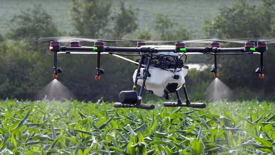
Drones’ utility extends beyond mapping and surveillance. They can revolutionize the application of treatments to your crops, such as pesticides, herbicides, fungicides, or fertilizers. Equipped with sprayers or spreaders, drones enable precise and controlled application of necessary products. They can target specific areas or individual plants, adjusting the product quantity as needed.
Using drones for treatment application offers several advantages:
- Time and cost savings: faster and more efficient treatment, reduced labor
- Resource conservation: precise product use, reduced waste
- Enhanced environmental protection: minimizing negative impacts on soil and water
- Improved safety: reducing workers’ exposure to chemicals.

Conclusion
The use of drones for the application of treatments represents a major advance for a more precise, sustainable and environmentally friendly agriculture. By combining advanced technology and agricultural expertise, this innovation makes it possible to optimize the use of resources, reduce environmental impacts and improve the quality of production. Drones offer tremendous potential for the future of agriculture, and their adoption continues to transform the way we farm our land.
