Filahi - Your Digital Assistant for Smart Farming
Enhancing farming with advanced technology. Use our web app to manage your crops using real-time data from drones and satellites. Identify problems, calculate yields, and more. Begin improving your farm today.


Explore Our Solutions

Satellite data collects detailed information to predict and compare crop health. Discovering early threats before they become issues. Allowing our users and pilots to get an overview of the critical crops that require immediate action or flight mission. Observations are updated weekly, providing key information to monitor crops remotely.

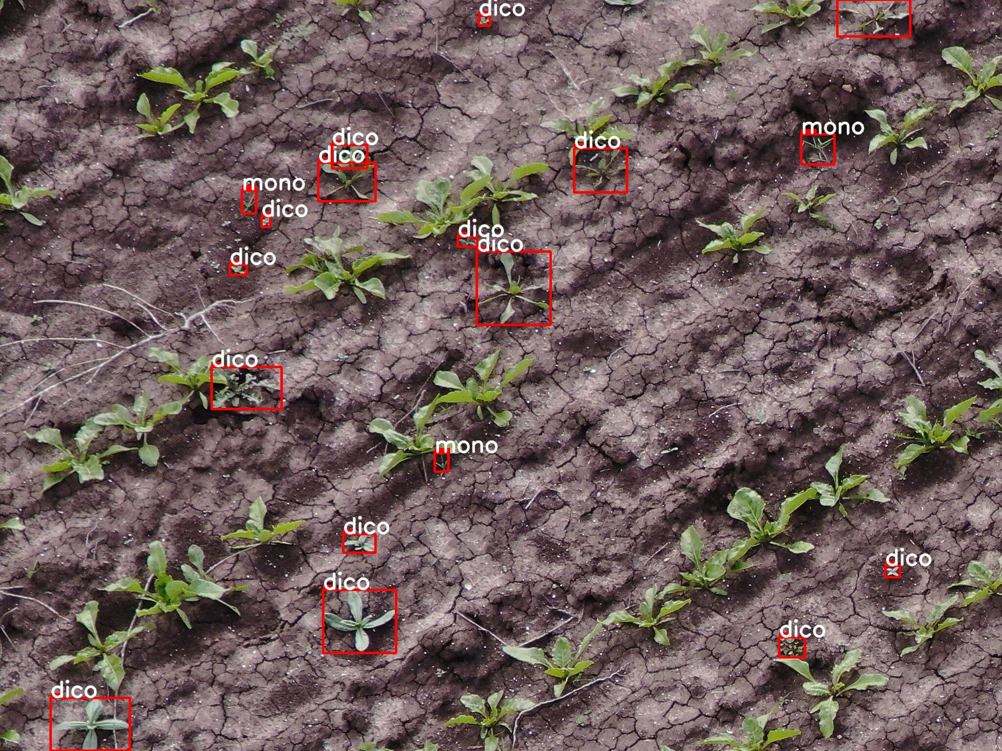
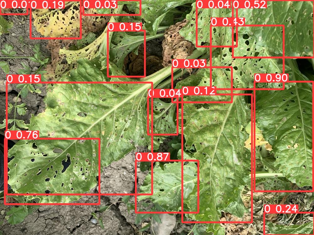
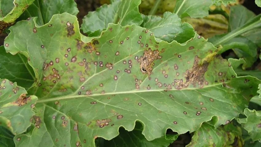
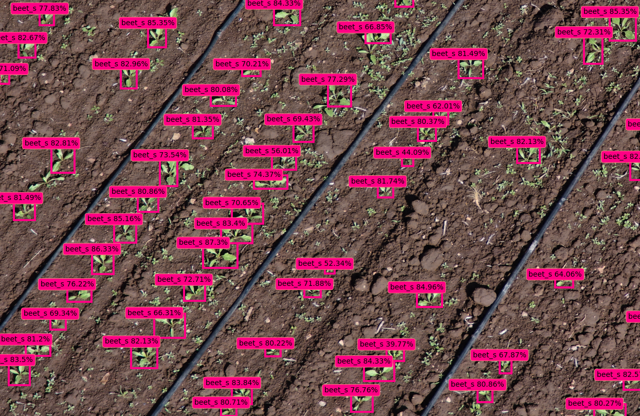
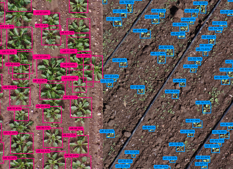
Using state of the art high resolution cameras to map fields to the millimeter accuracy, leading the way for the first time to precise leaf imagery. We developed advanced deep learning models to detect growth stage, weeds, insects and diseases in real time over our cloud based platform.

Our crop reports come up with spraying suggestions that not only save 90% of water but also up to 60% of pesticides or insecticides thanks to variable, autonomous and targeted spraying technology. A step forward for better chemical products management and decreased environmental impact.
Drone Intelligence for
Maximized Yields

Root Vegetables

Citrus Fruits

Wheat

Avocados

Palmier

Stone Fruits

Corn

Leafy Greens

Root Vegetables

Cruciferous Vegetables

Nightshades

Root Vegetables

Almonds

Prickly

Root Vegetables
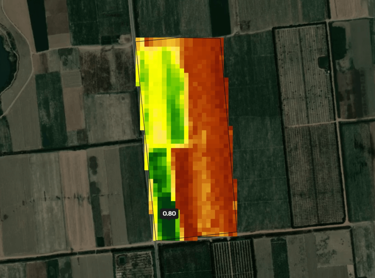
Multispectral
The vegetation indices , are essential tools in remote sensing, making it possible to assess the health of crops and to detect signs of water stress. Thanks to the analysis of satellite images, these indices provide precise information on the state of the vegetation, thus facilitating quick and efficient decision-making for farmers.
At Filahi, we combine the use of satellite images and drones to offer effective aerial monitoring of crops. Thanks to multispectral sensors, we capture precise data, revealing details invisible to the naked eye, which make it possible to generate vegetation index maps . These tools help farmers assess plant health and quickly detect signs of water stress or other problems, thus optimizing farm management.
Drone Monitoring
Real-Time Data Analysis for Drones
Real-time data analysis for drones means analyzing data from drones in real-time using advanced algorithms and machine learning models. This helps drone operators quickly make informed decisions and take immediate action. It is crucial for efficient and effective drone operations in industries like agriculture, construction, and surveillance.
Capture Images Using Drone
Capture Images Using Drone
Utilize drones to capture images, and then send the captured images to a server for analysis.


Analyze Captured Images
Analyze Captured Images
On the server, analyze the images to determine the percentage of weeds, insects, and diseases present.


Decide Next Action
Decide Next Action
Based on the analysis, the model decides whether it needs to capture more images or move to the next location.


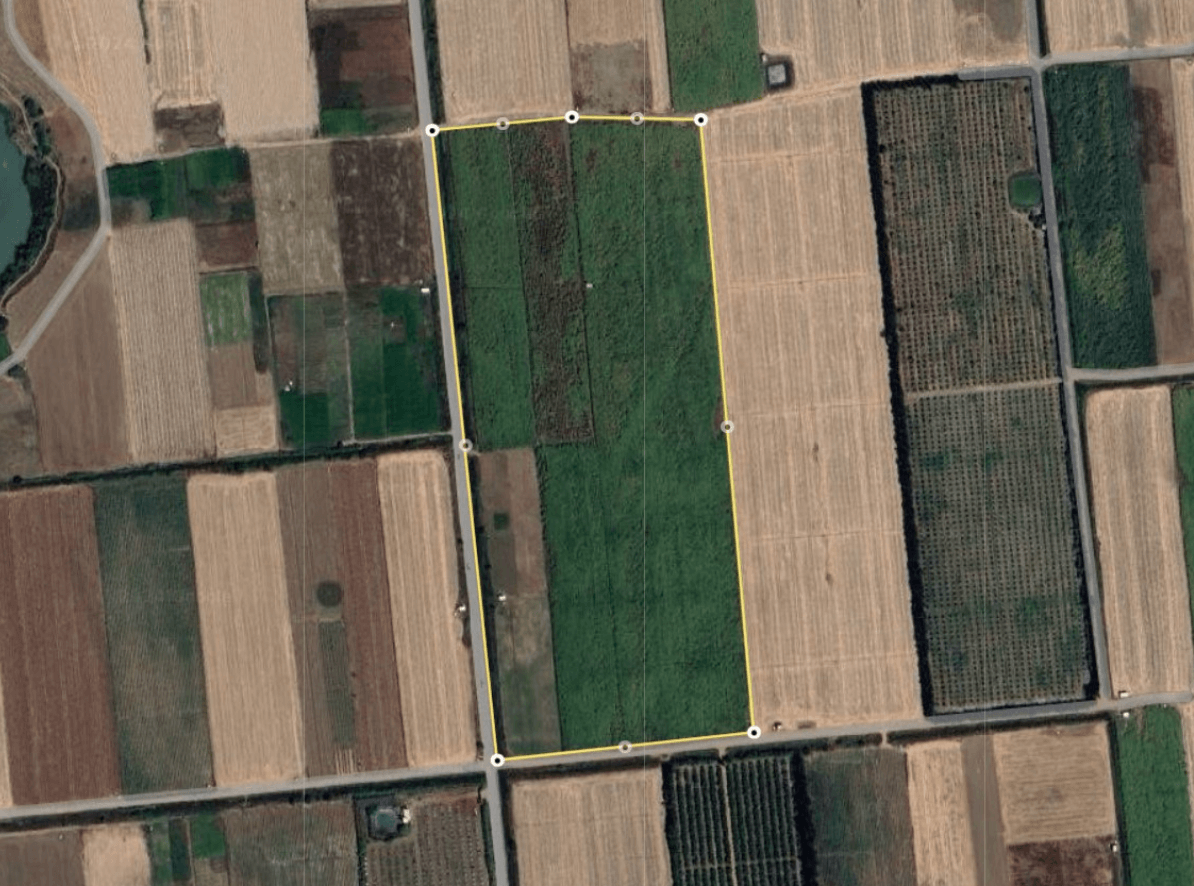
Scouting Images
Non-overlapping images collected in different parts of the field at different altitudes with the purpose of getting leaf-level details.
Contact Us
Team Members


